Introducing Seamless Integration: IGI CCNS-5 with RIEGL LiDAR Scanners
Unlock a new era of precision and efficiency in aerial surveying with the seamless integration of IGI CCNS-5 and RIEGL LiDAR Scanners. This powerful combination brings together two industry-leading technologies to deliver unparalleled performance and versatility in data acquisition.
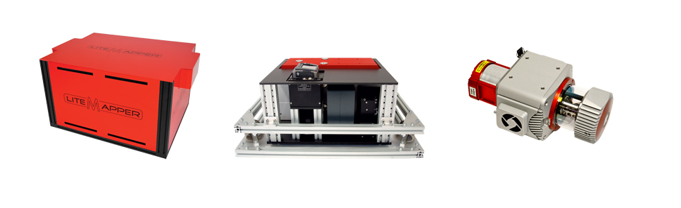
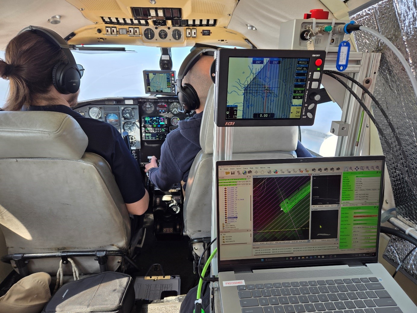
The IGI CCNS-5, renowned for its advanced Flight Management System (FMS), seamlessly integrates with RIEGL VQ airborne laser scanners, such as the new RIEGL VQ-1460 wide-area mapping system. The CCNS-5, together with its native mission planning solution IGIplan, provide a comprehensive suite of toolsets for optimal flight plan creation and execution of your airborne missions. It maximizes data acquisition efficiency, thus reducing environmental impact and contributes to overall flight safety.
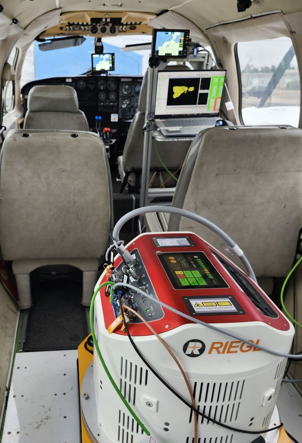
Earlier this year, XEOS Imagerie Inc. of Quebec, Canada received delivery of their RIEGL VQ-1460 airborne laser scanning system in combination with an IGI CCNS-5 computer controlled navigation system. The VQ-1460 offers a linear scan pattern for high point density and ultra-wide area mapping, with an extremely high laser pulse repetition frequency of 4.4 MHz and an effective swath width of 60 degrees. The system is capable of long-range detection from as far away as 5400m, resulting in extremely high collection efficiency. At an airspeed of 150 knots and with an average of 8 points per square meter, the VQ-1460 can collect as much as 615 km2/hour. The outstanding productivity in combination with the IGI CCNS flight management system convinced XEOS Imagerie to upgrade to the latest benchmark in LiDAR collection efficiency.
“I am always looking for the best possible solutions for our aerial mapping needs and this combination with the great support provided by IGI and RIEGL has exceeded our expectations”, commented Tony St-Pierre, President of XEOS Imagerie Inc.
Whether it is large-scale topographic mapping, mountain surveying in complex terrain or low-altitude corridor mapping for infrastructure projects, this complementing technology empowers surveyors with the ability to tackle complex projects with confidence and precision.
Join the ranks of industry leaders who trust the synergy of IGI CCNS-5 and RIEGL LiDAR scanners to drive innovation and success in aerial surveying. Discover the possibilities of seamless integration and unlock new opportunities for your surveying projects today.
About RIEGL
RIEGL is an international leading provider of cutting-edge technology in airborne, mobile, terrestrial, industrial and UAV-based laser scanning solutions for applications in surveying.
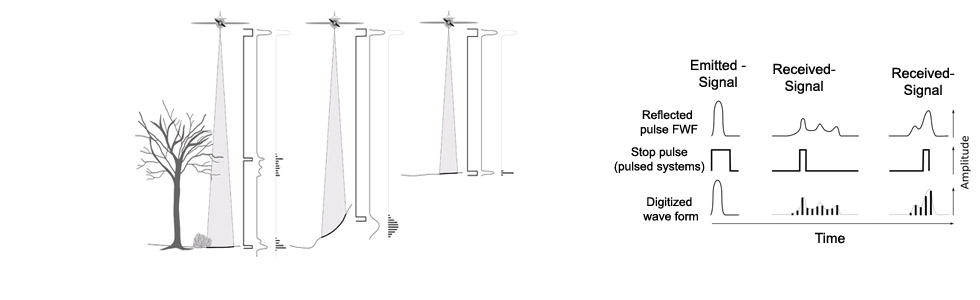
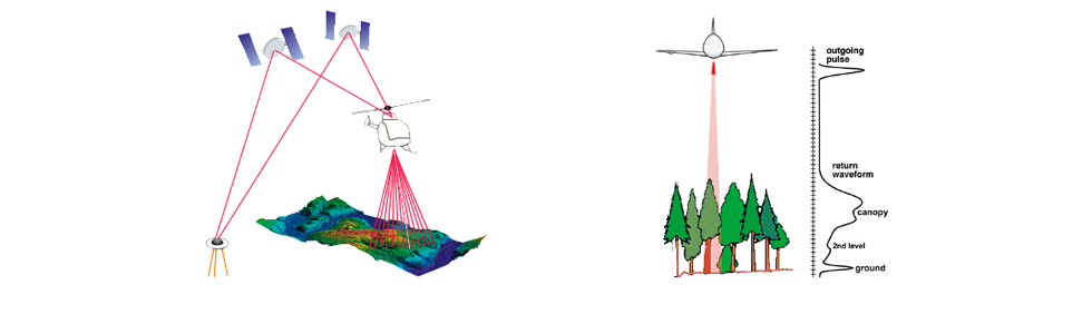
RIEGL has been producing LiDAR systems commercially for over 40 years and focuses on pulsed time-of-flight laser radar technology in multiple wavelengths.
RIEGL’s core smart-waveform technologies provide pure digital LiDAR signal processing, unique methodologies for resolving range ambiguities, multiple targets per laser shots, optimum distribution of measurements, calibrated amplitudes and reflectance estimates, as well as the seamless integration and calibration of systems.
RIEGL’s Ultimate LiDAR 3D scanners offer a wide array of performance characteristics and serve as a platform for continuing Innovation in 3D for the LiDAR industry.
From the first inquiry, to purchase and integration of the system, as well as training and support, RIEGL maintains an outstanding history of reliability and support to their customers.
Worldwide sales, training, support and services are delivered from RIEGL’s headquarters in Austria and in the USA; main offices in Japan, China, Hong Kong, Australia, Canada, UK, Germany, and Chile; and a worldwide network of representatives.
About IGI
IGI, the first company to introduce a GPS based flight guidance system, revolutionizing aerial surveying. Learn how our groundbreaking technology elevates the efficiency and accuracy of aerial survey to unprecedented levels, setting global standards. Trust IGI systems to support your surveying projects with the highest precision and reliability.
read more...